Zooming down the highway between Lismore and Casino at 100km/h, it is easy to speed obliviously past an interesting piece of history by the side of the road. Heading from Lismore, after 22 kilometres is a small road reserve on the left that can easily be missed unless you are looking out for the Schielers Road turning on the right that lies directly opposite.
Located between a cypress tree that is home to a lively willie wagtail, and a bus shelter, is a large cast iron ‘boiling pot’ of the same design as is found in old-fashioned cannibal cartoons where the hapless explorer or missionary is on the menu.

Accompanying it are historical markers indicating that this was the site of the old Tomki homestead. Both the boiling pot and the nearby remains of the historic Tomki station (stone stables, hexagonal meat house and a bell) at 2135 Bruxner Highway are on Richmond Valley Council’s heritage list.
In 1841, a couple of men named Henry Clay and George Stapleton had reserved a squatting run at Tabulam, but because they arrived late it was forfeited. Instead, they opted to drive their herd of cattle across the hills to the Richmond River where they reserved about thirty thousand acres of land and built a dwelling at this spot.
Among the first recorded European settlers in the North Rivers region, they named their station Cassino, after the Italian hilltop town of Monte Cassino. At a nearby spot on the Richmond River that offered one of the few safe crossings, a settlement known as The Falls emerged. In 1855, when this settlement was gazetted, the name was recorded as Casino, Taking its name from the Cassino station, nobody is sure exactly why the second ‘S’ went missing.
Unexpectedly, an 1842-3 financial crisis threw Clay and Stapleton’s plans into disarray. In 1843, their property was purchased by an English settler named Clark Irving, who renamed it Tomki, a name that is believed to originate from the Bundjalung word damgay, meaning ‘greedy.’. Irving took on the role of a grazier, with a number of stations in the Darling Downs, Gwydir (New England) and Maranoa (southern outback Queensland, centred on Roma) districts. Later on he also went into politics and became an MP.
The Tomki name lived on in the form of Tomki Shire Council, headquartered in Casino but excluding the town itself, which was a separate municipality. Tomki Shire later disappeared when it was amalgamated with Woodburn Shire Council in 1976. Today, the Tomki station, which once gave Casino its name and stretched far downstream, is largely forgotten other than as a sparsely populated rural district, a creek, a couple of road names, and a cargo steamer that was wrecked at Ballina in 1907.
On a day when it was warm and sunny, with white fluffy cumulus in the sky, we were curious enough to visit. The subject of historic boiling pots had just been raised on the Good old Days in and around Lismore N.S.W. Facebook group. The purpose of these giant pots was to boil cattle for the production of tallow, which in the 19th century was widely used for candles as well as a lighting oil. Irving also tried selling salted beef, including shipping it to Mauritius, but this proved to be uneconomic.
Each head of shorthorn cattle from the Tomki station yielded about three hundred pounds of tallow, and neighbouring stations’ cattle were processed there too. As the technology improved, the steam boiling pots were eventually superseded by ‘digesters.’ For a while, tallow was one of the North Coast’s major exports, but received a setback in 1857 when it became more profitable to supply surplus stock to Victoria and Queensland.
The pot on display was operational from 1847 into the 1850s, and was one of several to be used here. Its diameter is about two metres, with the words ‘Russell Sydney Foundry’ embossed on the side.

Today, it has some visible cracks that might be worth repairing, and there are two sets of steps up to the sides that allow you to look down inside. At the front is a large tap.
In addition to the Tomki operation, tallow was also produced at a larger industrial-scale plant set up in the early 1850s by Edward Hamilton at Woram, close to Tatham and Greenridge. This was located on the west side of Deep Creek (today generally known as Shannon Brook), and was part of the large Wooroowoolgen station.
* * *
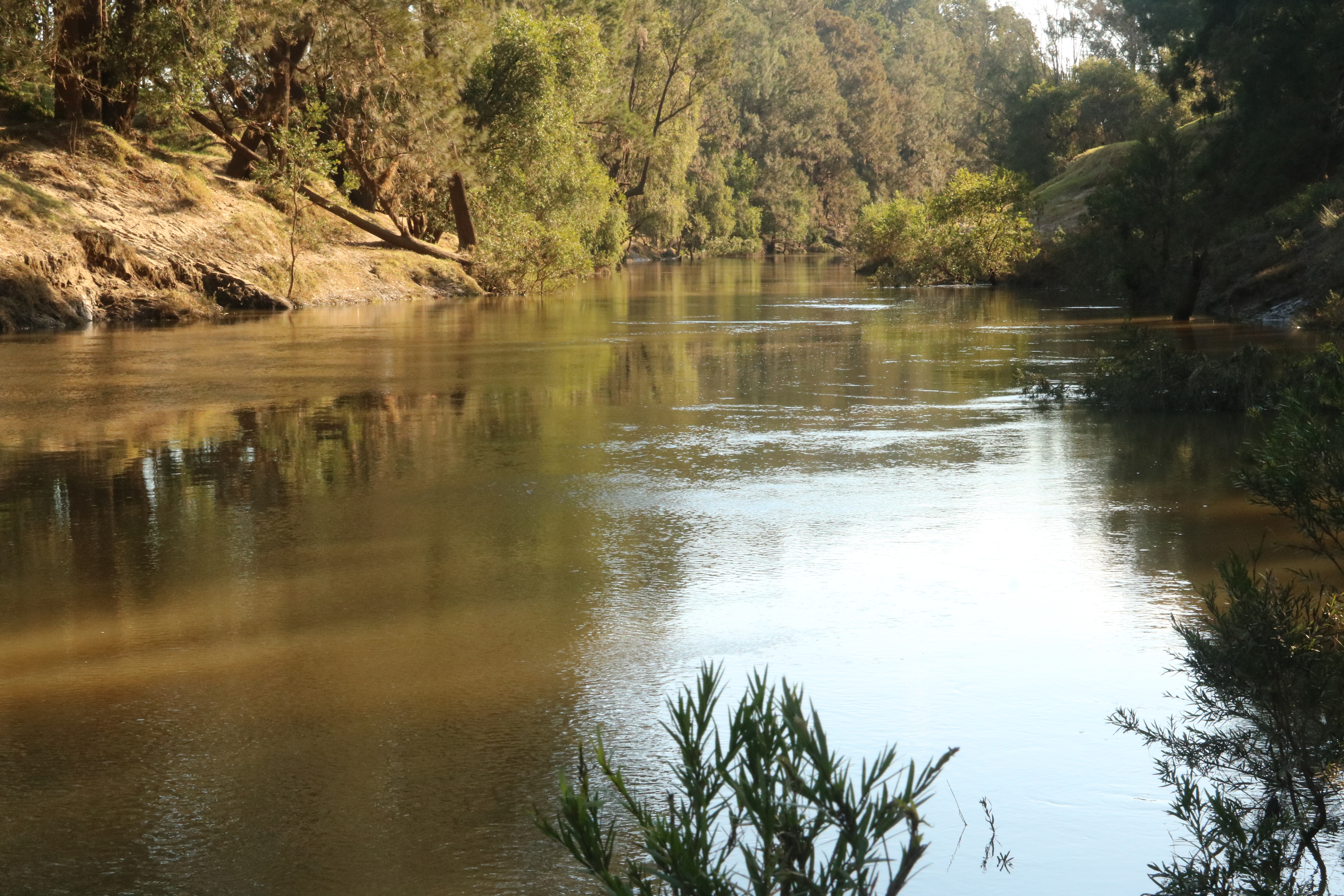
Past Clovass, the Richmond River weaves around a little to the south of the Bruxner Highway, although the only clue to its proximity is the flatness of the land. Further down the road from Tomki, a few kilometres closer to Casino, is Irvington Wharf Road. Travelling around the region and keeping an eye on things, it’s hard not to notice, and be curious about, side roads that head off to major rivers and which contain the word ‘wharf’ in their name.
Named after pioneer settler Clark Irving, Irvington suggests the existence of a town, but unsurprisingly, today it is just another rural district. The dirt road zig-zags, degenerates into a rutted farm track with a swathe of grass growing down the middle, and ends after about 1.5 kilometres at a gate with an old sign in decaying green lettering stating ‘Public Access Into Reserve.’ Ahead, a line of casuarinas marks the river, while off behind, highway traffic is audible in the distance.
Once the rivers were the region’s only means of large-scale goods transport, and it is tempting to think of old wharfs as the distribution hubs of the 19th century and early 20th century. The first Irvington Wharf was built in the early 1880s, about three kilometres downstream from Casino, but was abandoned due to the river becoming too shallow. Another wharf was then built at this location in 1898.
Coraki was once one of eastern Australia’s most important inland ports, and transport of goods from Sydney involved ocean-going steamers docking at the Coraki wharf. Cargo was transferred into droghers, flat-bottomed river boats that travelled the waterways. Irvington was considered to be the head of the river, as beyond this point the river level was often too low for most boats to navigate further upstream. It was the primary transport terminal for items destined for Casino or Kyogle that generally continued on their way in horse-drawn carts.

Irvington was also important to the timber industry, with logs being floated down the river from this spot to ships and mills at Coraki.
After a couple of decades as a bustling hive of activity, wharf operations were discontinued here in 1920 by the North Coast Steam Navigation Co., and freight operations were switched to rail.
Parallel with the port was a village, which once boasted a community hall, school, hotel, post office and telephone office. Unfortunately its decline started early, with the pub closing its doors in 1911, and the school shutting in 1933. It is a reflection of the rural exodus in the Casino area that virtually no satellite village, of those that remain, has a store; in comparison, the Lismore area has fared much better.
An earlier look at a Google Map of the wharf road showed that from here the wharf was likely to be some distance off to the left in a diagonal direction. I make my way across the field, and down a fairly steep river embankment to a spot where there is a view downstream. Some mud from the flood 2½ weeks ago has coated the bank, but it has mostly dried. A small amount of water-borne litter is well above the river level.
In the river, which is still brown, lying just above the present water level is a horizontal remnant of the wharf that at first glance looks like a log that has become stuck in the shallow water, except that it is too neat. Comparing it with a 2001 photo from a Richmond Valley Council heritage document, taken from same vantage point, suggests that there has been some disintegration within the last 16 years. Just visible beyond is an end of the wharf projecting into the river, with a cormorant perched on top.
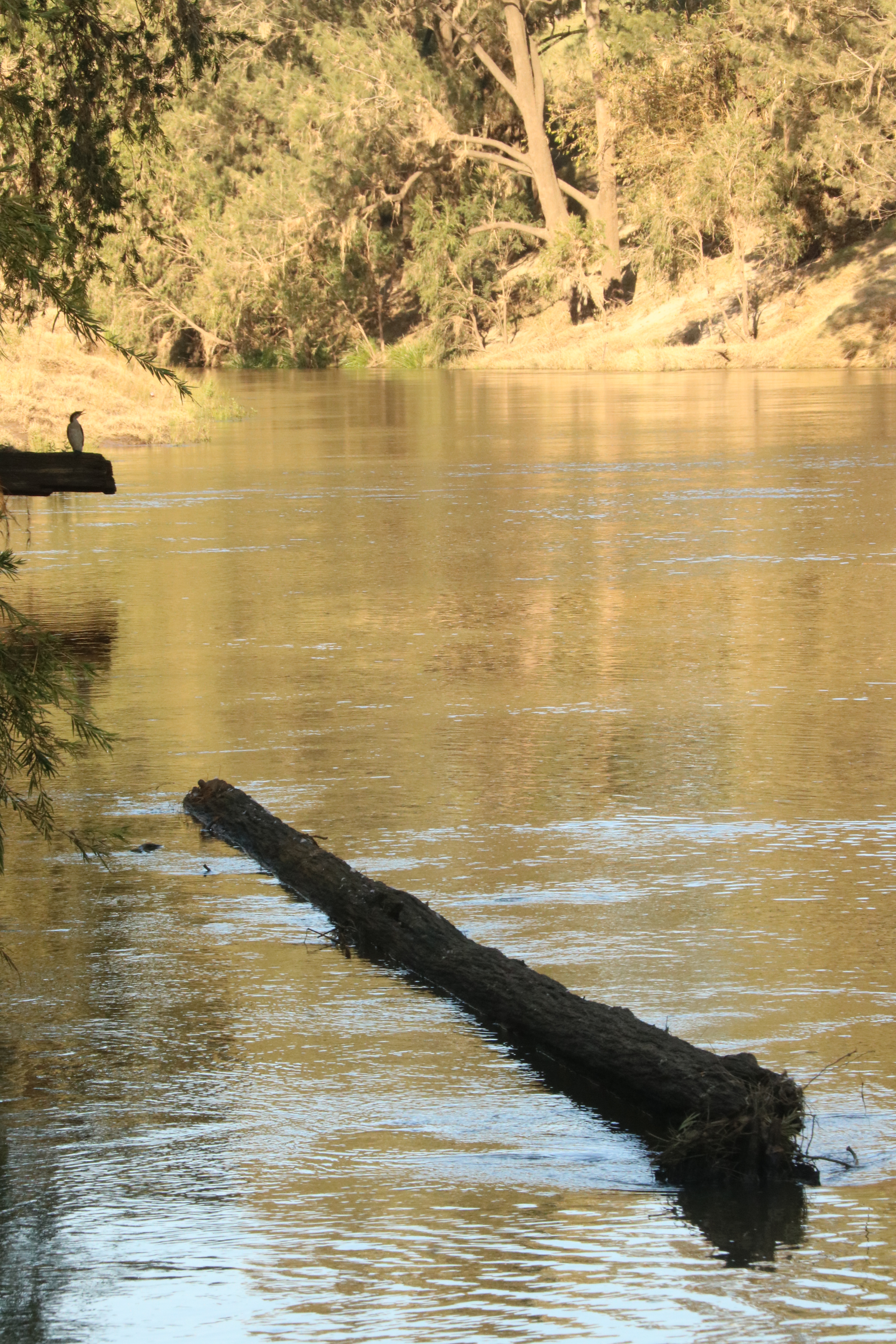
This very peaceful spot has definite potential for tourism that is as yet unrealised, but today we are thankful for the absence of large signposts and obvious paths that can turn an exploration of the unknown into something tamer. A duck flies upstream, and a glimpsed object falls off a tree on the other side of the river, making a loud splash. Light flood debris in the trees extends up to about twelves metres above the water level.
Heading a short distance along the top of the bank towards the location of the wharf, the route has the feel of an old farm track.

Wind creates a gentle rushing sound through the casuarinas. Desending via a circuitous route, at the bottom is an ideal vantage point for an overview of what is left of the wharf structure. A couple of well-weathered horizontal timbers jut into the river, while another pair extends about half the distance. A line of horizontal poles runs close to the bank, with the tops poking above the river. The dried mud has dingo or wild dog imprints.

On the walk back, an obvious diagonal stretch of embankment aligned with the top gate marks what must have been the old track down to the wharf, before it fell into disuse. Lining it are three fenceposts, each with a vertical set of large holes for wire to pass through. In a historic photo of the wharf from the book Thematic History of Richmond Valley Local Government Area this former stretch of track is clearly visible rising uphill from the wharf towards the now-vanished village.

Pleasure to read this sojourn along a watery pathway that once was an artery for early settlers. Little remains along the river of the early European settlements and for us the only pathway to revisit is through our emotions retrieved from care worn faded photographs. For we are not only revisiting lost localities, but the hope and dreams of that past generation and the reminder to us of our own fragility.
LikeLike
Thank you for sharing this thoughtful comment.
LikeLike
I enjoy this litle snippet of History and People because when I travel past here I always look out for the tallow pot and the old stables which are nearby. Made of sandstone blocks, believed to have been used as ballast on the ships which came up the river, they are decaying a little.
Also one of my ancestors, James EXTON, used to cut staves at this spot when times were tough, and they were used in the making of the barrels for the transport of the tallow.
The boiling down works thrived in hard times when the prices for the beef were too low to make the sale of the beef viable.
LikeLike
Thanks for the comment, and for supplying some fascinating extra pieces of history.
LikeLike
My father Eric Whiston leased a dairy farm at the end of Irvington Wharf Road
Have no idea how long we we were there We were there when I was born in 1937
He joined the army reserve the day before I was born.
We left when I was 4yrs & moved to Casino to live with mums sister
Dad was in the Army served in New Guinia
Did visit many years ago. The old farmhouse was still there
Looked pretty sad,.
LikeLike
Thanks for your reminiscences. It’s sad, and also fascinating, how things change over time.
LikeLike
Thanks for sharing this wonderful information. I am currently writing a kayaking and canoeing guide for Casino and I recently paddled along this stretch of river. The water level was much lower and the “horizontal remnant of the wharf” you mention was above head height for me. I have photos if you are interested.
LikeLike
Thanks for sharing this. At the time I was oblivious to the river level being higher than normal. Good luck with your guide.
LikeLike
My Grandparents had the Commercial Hotel in Coraki from 1911 to 1913. It had to be rebuilt after a fire, which they did, and the pub was eventually consumed by fire many decades after that.
LikeLike
Thanks for sharing this interesting piece of local history.
LikeLike