It was Henry Miller who once said ‘One’s destination is never a place, but a new way of seeing things.’ To step outside one’s zone of familiarity and to look at the world from a different perspective is a gift, one that can rewire your brain slightly in the process.
I had been fascinated by the Booyong-to-Ballina railway branch line since first hearing about it last year. Closed decades ago, few people are aware of its existence today. This route is like a hidden overlay superimposed onto the map, making elegant T’ai-chi-like arcs across the landscape that contrast markedly with the comparatively angular and disjointed road network. Using Google Earth satellite images, the path of the old line can fairly easily be tracked as it winds its way in a south-easterly direction. Only when it reaches West Ballina is it mostly lost without trace.
One local history expert who has investigated the line is local historian and author Ian Kirkland, based near Alstonville. His father was a doctor in the construction camps that sprang up while it was being built, with the workers sleeping in tents. Ian covered its history in his short book Out of Puff. published in 2006. Over the phone, he was able to give some history, and run through some of the remnants that still litter the route.
Through the Good Old Days around Lismore NSW Facebook group, I linked up with Allan Hicks, another Booyong-to-Ballina researcher, who had checked out all of the rail remnants, and was able to pass on some useful tips. As I picked up information of my own, networking started to flow in both directions. Through Allan, I heard about Peter Sanderson, an older enthusiast based in Wollongbar who had gone to the trouble of building a scale model of the whole line.
Researching this post involved compiling a list of all significant remnants, filling in gaps as I went. It also involved getting to view numerous different sites, making eight trips, and visiting some private properties in liaison with the respective owners. This was not a tourist experience; it involved edging on my back under barbed wire fences (with permission), squelching through wetland, passing through waist-high grass, and scrambling down an embankment. Walking the old line, where this is possible, is a little like a pilgrimage down a ley line or ancient path. In this case, it involves swapping the trackways for raised embankments, and trading standing stones for prefabricated concrete blocks.
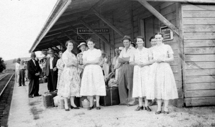
Locals started pushing for a Ballina rail line in the 1870s, but due to some contentious regional politics it was not until 1923 that construction finally began. This milestone was accompanied by lively celebrations in Ballina that included a parade. After some delays, and running three times over budget, in 1930 it was complete. The official opening date for the line was 20th September 1930, despite trains having already travelled along it for months. Passenger services ran daily, and trains also carried goods. All of the trains at the time were steam locomotives.
Stretching for 12.8 miles (20.6 kilometres), the line had five level crossings where the driver would blow his whistle when approaching. At another spot, it passed under the road via a short tunnel. In the best conditions, maximum speed was 30 mph (48 km/h), which reduced down to 15 mph (24 km/h) when travelling at night with the lights off. Because the line was unfenced between Booyong and Ballina, drivers had to keep a look out for wandering stock. Cuttings were created at various points along the route, in at least one case into solid rock. At West Ballina, issues were experienced with ground subsidence, which were resolved by laying down logs along a part of the route.
The Ballina line bifurcated from the Casino-Murwillumbah line at Booyong junction, a little way to the west. In the order that they were encountered from Booyong Junction, these were the stops:
- The Halt (formerly known as Kirklands, opened in 1940)
- Tyumba
- Nioka (opened in 1942)
- Teven
- Miroma (opened in 1940)
- Ballina
Tyumba, Teven, and Ballina were stations, while the other three were just platforms. The unusual names Tyumba, Nioka and Miroma sound possibly Aboriginal, but information about their origins appears to have been lost. Despite investigating, I was unable to discover anything.
The fatal flaw in the line’s design was that, rather than extending to Ballina’s port, it stopped about three kilometres short. For businesses, this deterred the rail transport of goods, given that horse and cart transport was required at the other end. Beachgoers meanwhile were disappointed at the long walk to the beach, unless they took a taxi. Calls for the line to be extended to Ballina’s port were not supported by the state authorities. This lack of connectivity discouraged usage, undermining its economic viability. During every year of its operation, the line made a financial loss, and this was a major factor in its premature demise.
The passenger service discontinued in 1943, and after serious damage to the track after heavy rain in the region in 1948, the line shut down for good in January 1949. Most likely, this weather event was seized on as an excuse: in order to later dismantle the line, the stretch of trackwork at Teven had to be repaired in order to transport an engine through to Ballina and rip up the track from the end of the line backwards.
In preparation for visiting the line, I had the list of remnants, a series of satellite images covering the length of the route, the Casino State Forests map (fairly useless except for following the road layout), and the Lismore 1:25,000-scale map, showing the rail line route stretching from close to its origin to south of Teven.
In order to protect the privacy of some property owners, I’ve chosen to be a little vague about certain locations. Where remnants occur on private property, it is strongly recommended to seek permission before checking them out. Most people are very willing to allow access.
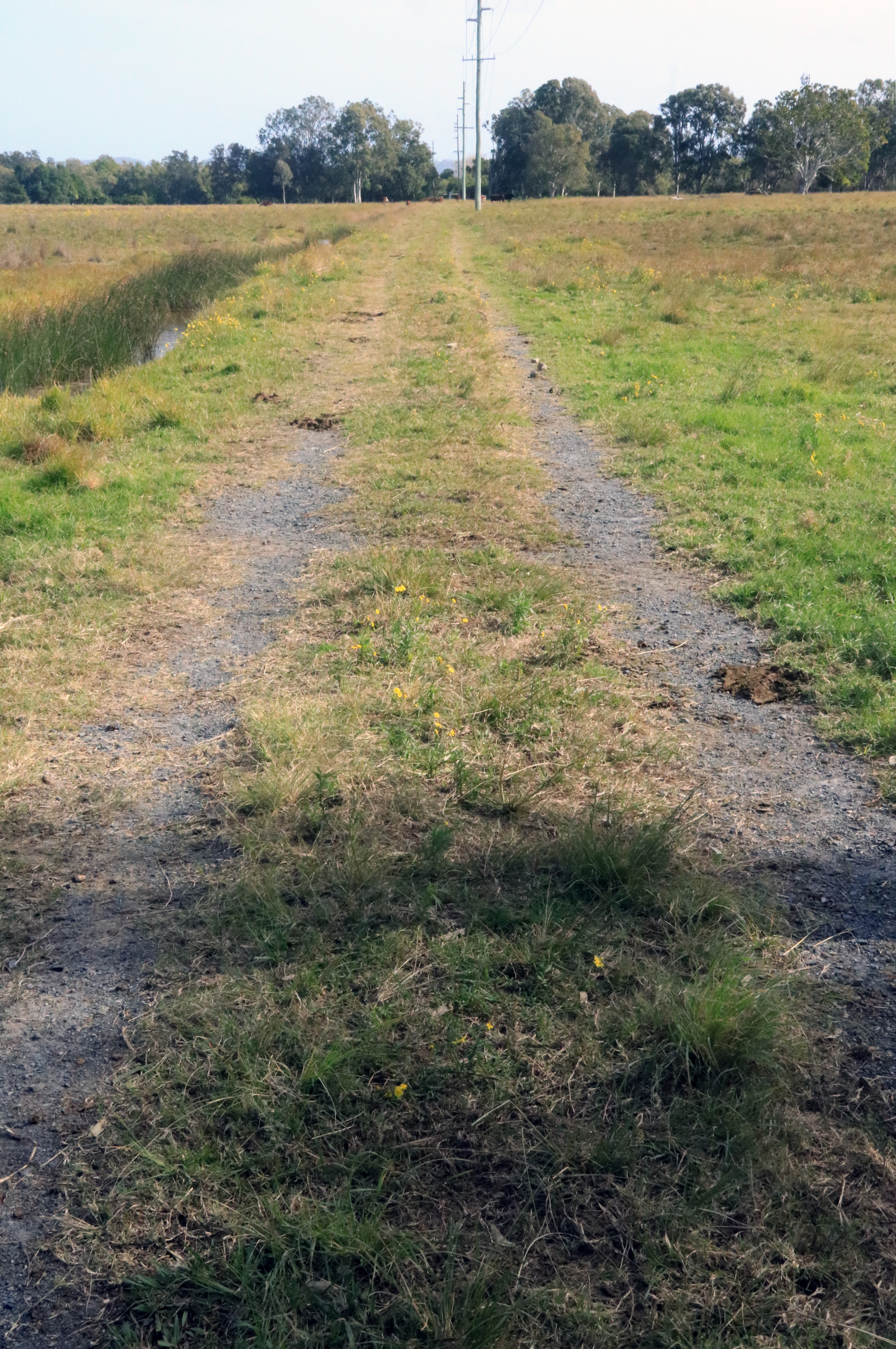
It is a fairly warm and sunny autumn day in May, and a clear blue sky has given way to small white fluffy cumulus. Booyong seems like a logical place to start, and then to follow the route. Close to the tennis courts is a short grassy track ending in a gate, the other side of which is the disused Casino-Murwillumbah line. This was obviously the main station access. A wonga pigeon calls in the distance from the reserve. Despite visiting Booyong many times, it had never occurred to me to check out the old platform, which, turning right along the track westwards towards Lismore, starts after a few metres.
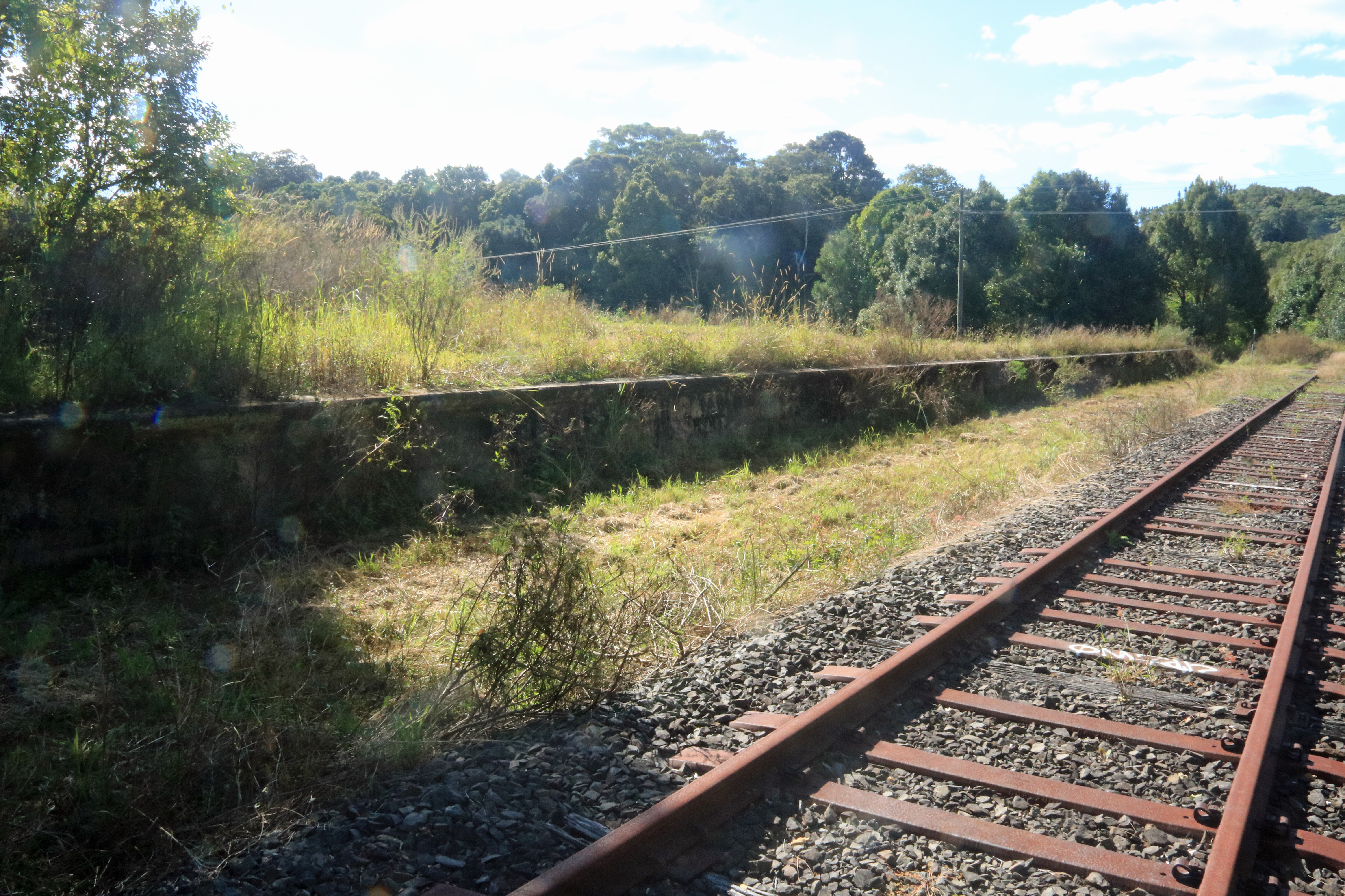
Booyong Junction was a simple junction without a station or platform, located about seven hundred metres west of Booyong station. The only publicly accessible way to access the junction’s location is by walking the disused line, something that has a novelty value and feels vaguely cinematic. After about a couple of hundred metres there appears a crossing over Pearces Creek, and while the creek is not very wide, the drop down is substantial. Part of the issue with this type of crossing is the gaps between the sleepers. These are not a practical consideration if you watch where you tread and are sure of the sleepers, but not far ahead one of them is broken. I decide to play it safe and retreat. (Allan followed the same route independently, and went slightly further, until he found a sleeper that felt a little weak.) Another potential access from the other direction starts at Laureldale, near Eltham, and is far longer in addition to having its own creek crossing to content with.

Fortunately I was later able to visit a private property and check out what is left of Booyong junction without risking my life on a dodgy bridge. There are barely any signs left betraying the exact location of the junction, but it can be estimated due to the presence nearby of a short curving stretch of remnant embankment that can be mentally extended to the Casino-Murwillumbah line.

A couple of kilometres out of Booyong, if you take the straight stretch of Pearce Road southbound towards the T-intersection with Houghlahans Creek Road, the route of the rail line comes sweeping around in an arc from the right, although virtually no vestiges remain in that direction. Crossing the road close to a driveway, over to the left begins a substantial embankment as the line makes its way towards a second crossing of Pearces Creek. It is easy enough, like me, to pass along this road regularly and remain oblivious of the embankment, let alone its interesting significance. I walk a short distance down the road to view, across a field with multicoloured cows, a series of concrete blocks that once supported an rail bridge over the creek. Like all of the creek crossing bridges, this one has long been dismantled.


At the end of Pearce Road, turning left onto Houghlahans Creek Road offers a panoramic side view of the same bridge crossing, plus a wide vista of the embankment as it runs diagonally with the road.
The Halt is notable for its understatedly poetic name, which successfully transcends all references to the geography of its location, and also for being the first stop. A little way down Houghlahans, heading east, is the next road crossing. Here the gentle raised embankment of the line has been repurposed as a driveway track.

Where the platform used to be is a house, whose owner informs me that no trace of it remains, although he does dig up the occasion rusty nail.
Walking together towards the rear boundary, the embankment resumes, continuing into a neighbour’s property. Most curiously, in the distance is a modern-looking train sign marking the point where it crosses a driveway. It is nice to see how the memory of the Booyong-Ballina line is being kept alive in such ways. All properties in the area were once owned by the Kirkland family, hence the original name of this stop.
Houghlahans Creek Road, running from Eltham Road in the Booyong-Pearces Creek district to Teven, has a special relationship with the line, winding alongside it and crossing it in three places. Interestingly, it was also referred to as ‘Hooligan’s Creek’, but the name has since vanished. The next landmark to look out for is the Houghlahans junction with Kirklands Lane, where a short distance up this side road is a prominent faded sign with the name Tyumba. This was originally located at the station, but was relocated to make it visible to the public.

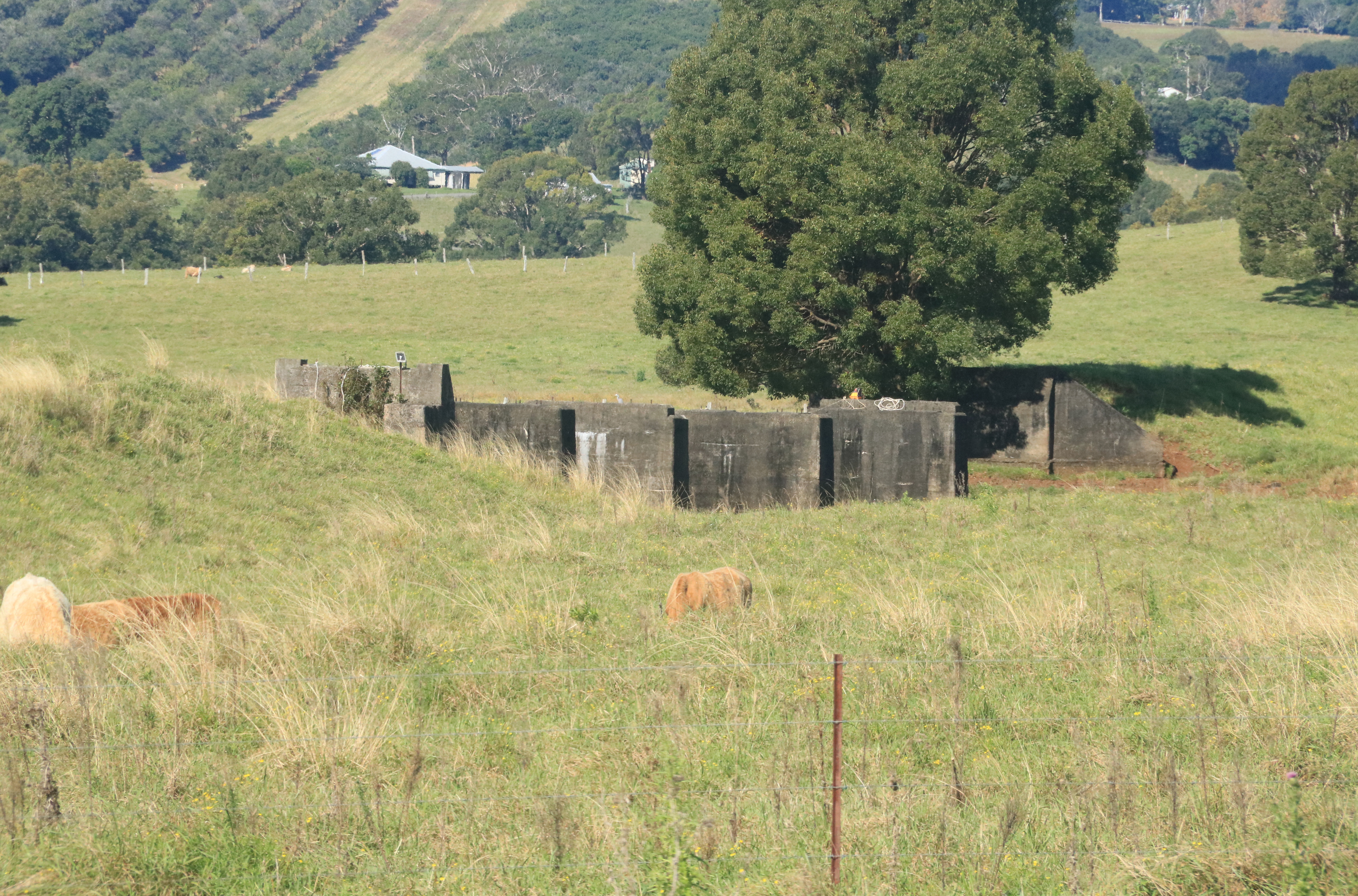
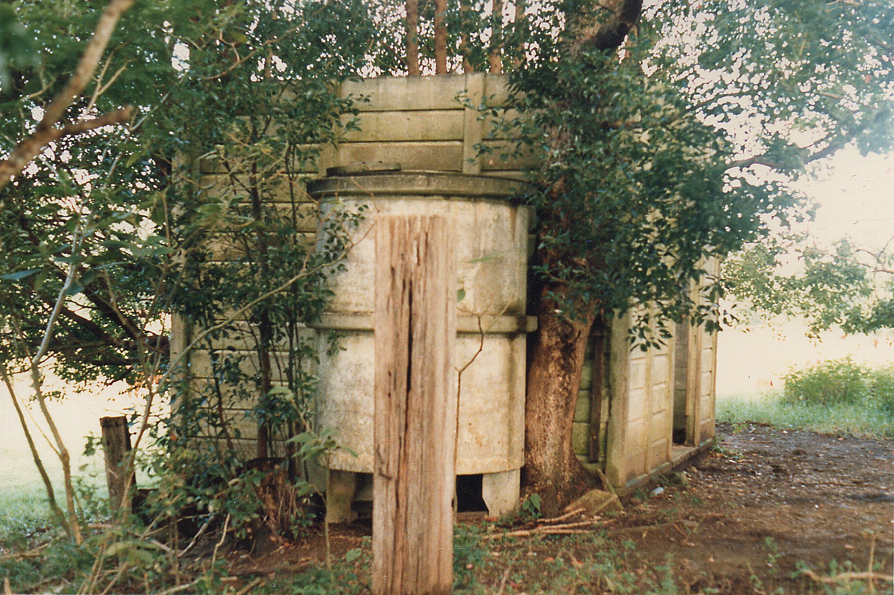
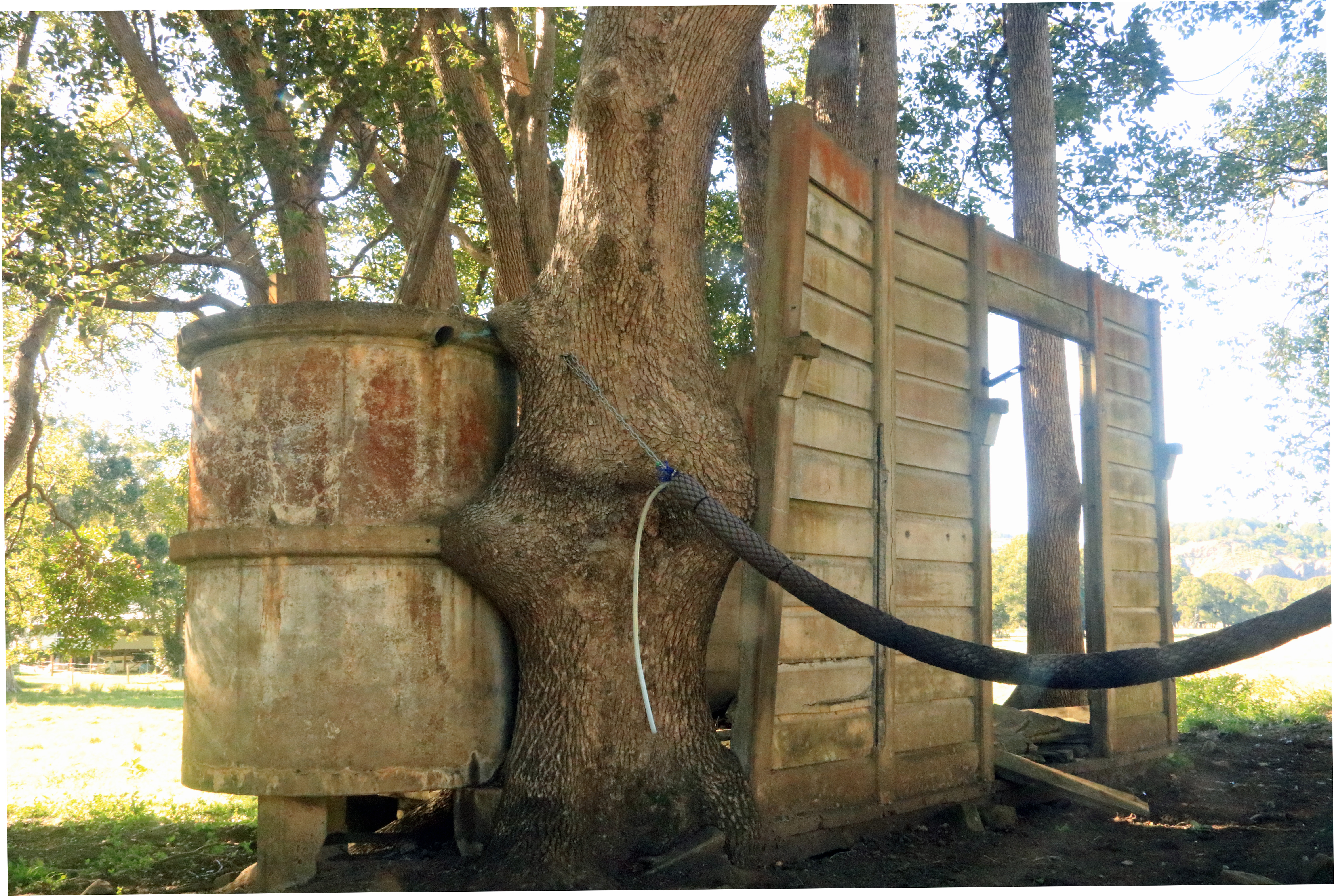
This station once had a goods loop, pig race, and truck loading and unloading facilities. Today there are two remaining structures, both in good condition, and now incongruously located in the middle of a large macadamia plantation, mixed among a cluster of silos and sheds. By arranging with the owners, it is possible to view them. The access track passes macadamia trees on one side, with the empty fields of another property on the other.
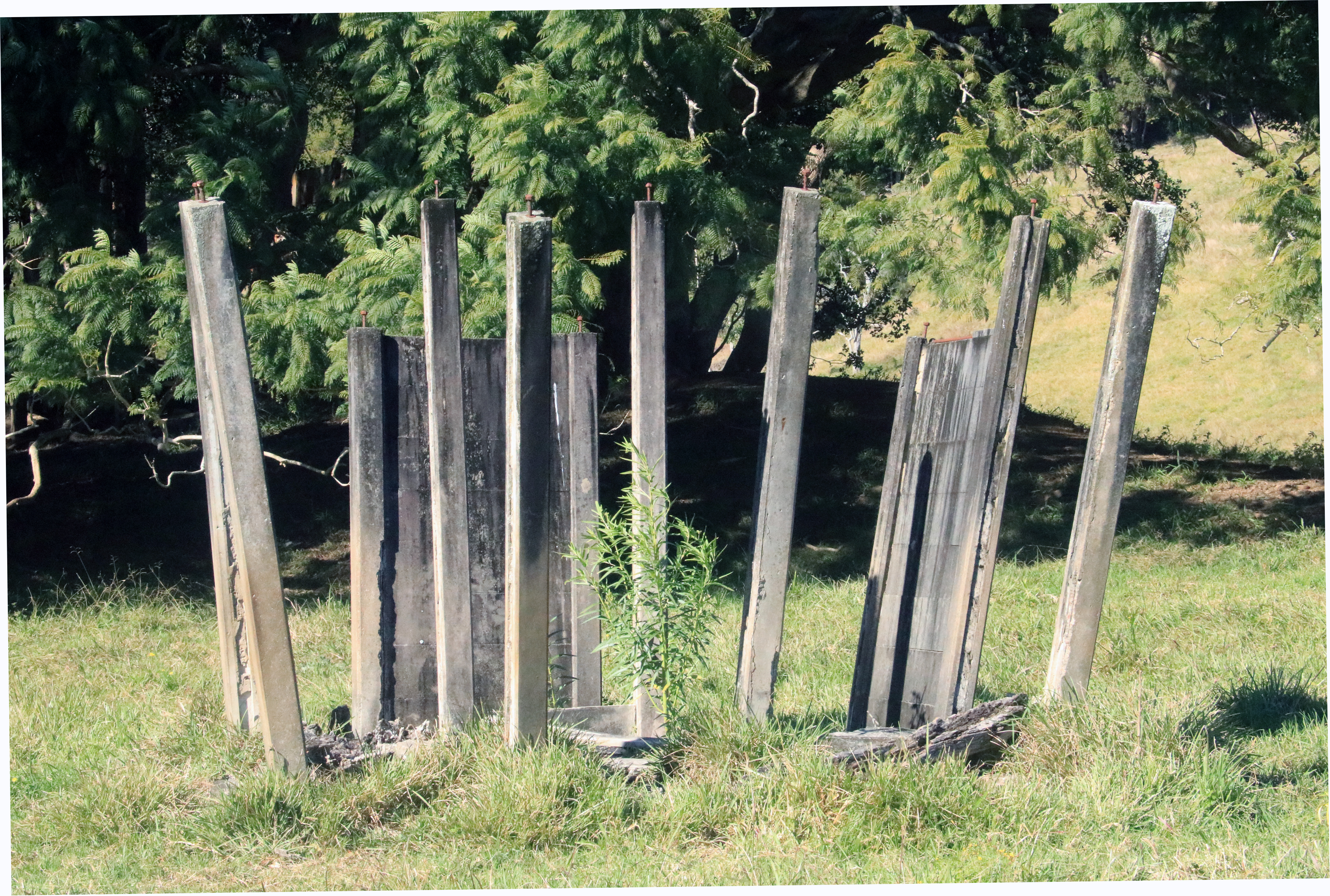
The waiting room is in a slightly elevated location, at the top of a small mound. About the size of a small shed, it was built from horizontal prefabricated concrete panels, and while not hugely aesthetically appealing, this is outweighed by its historical interest. For railway buffs, apparently this type of building was known as a PC2. Inside, the most notable features are the heavy wooden doors, which slide along a runner while supported by bulky heavy-duty metal hangers.

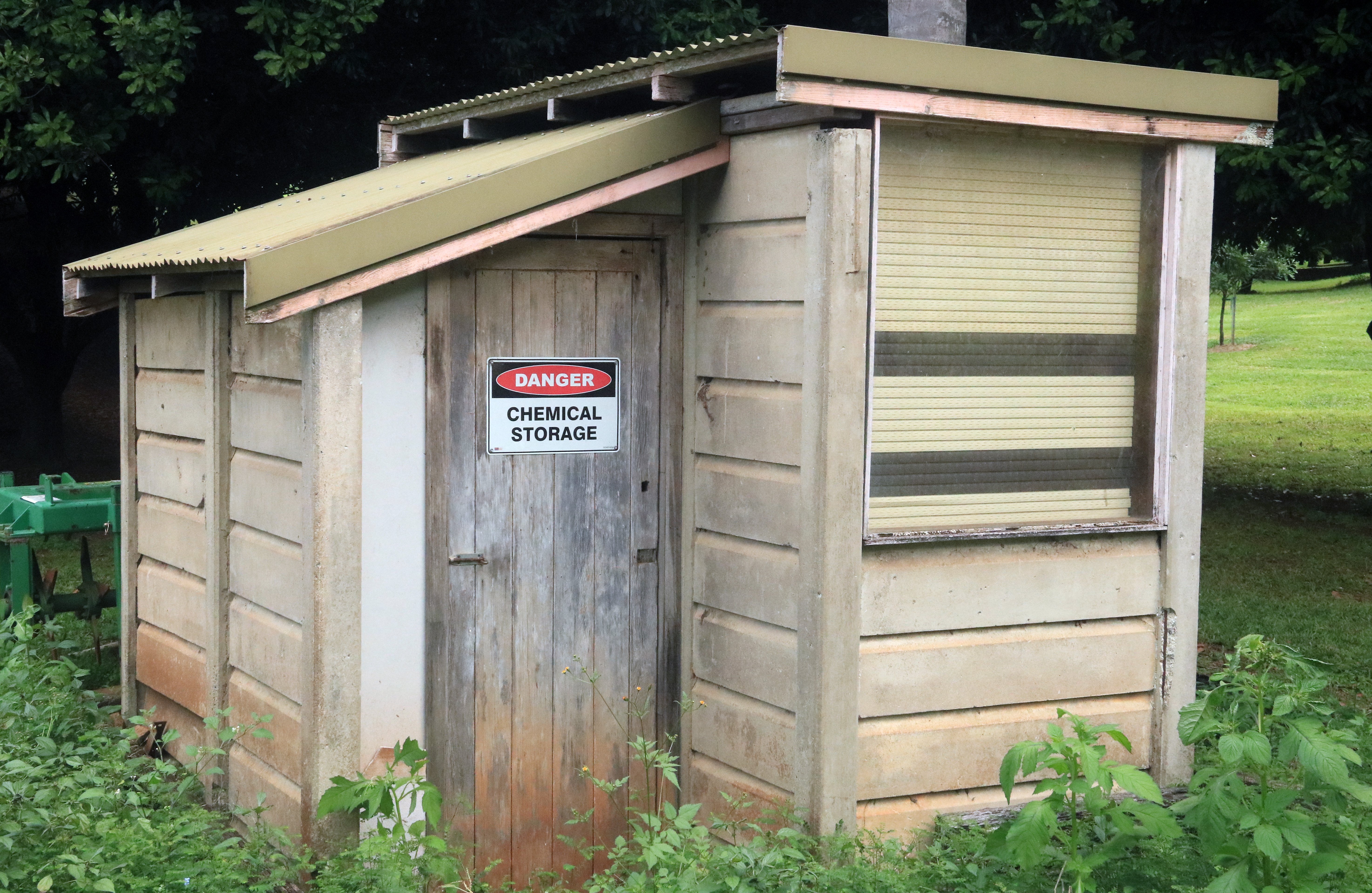
Having reached a state of disrepair decades ago, it was renovated in order to be converted into a dwelling, tiny-house-style, with some new features not in keeping with the original. Despite my having heard that the building had been relocated, it is still in its original spot. Some confusion may have come about because in an earlier photo it is surrounded by camphor laurels and other undergrowth, which have since been removed, leaving a very different-looking clear area today. Nearby is the toilet block, another prefabricated structure that is now used as a chemical shed. In 1949, a tender for the demolition of both buildings appeared in the Sydney Morning Herald, but fortunately this event never occurred.


In order to obtain a sense of where the line travelled after leaving Tyumba, I’m invited to take a bumpy ride with the owner in a golf cart, diagonally through the macadamias, adding a couple of notes en route while attempting not to be unexpectedly jettisoned out. Some distance further on, I am told that there was a dam along Houghlahans Creek where water was pumped for use in the engines.
Just a short distance along Houghlahans is its second rail crossing, very easy to miss as there are no features readily visible by the road. To the right, it is marked by a small, steep and narrow gully, with the line formerly passing under the road through a short tunnel. A short distance beyond is Tyumba Avenue, a no-through-road track on the right. I explore it, following an idealistic long-shot that it might yield a clue about the origin of the Tyumba name, but draw a blank.
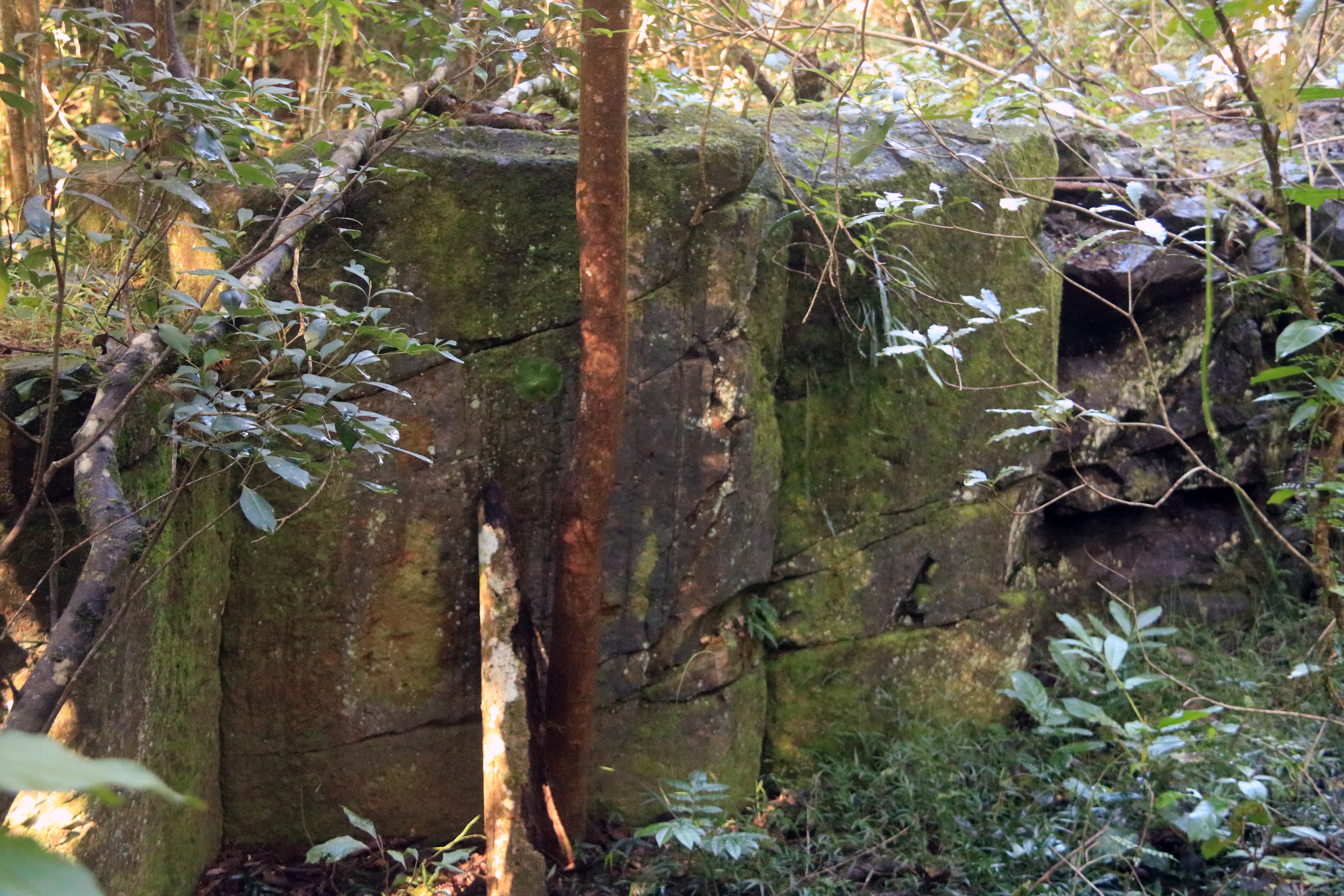
At a property a short distance further on from Tyumba is a unique railway feature whose existence I was already aware of, and which I was lucky enough to visit. At the back edge of the cleared part of this acreage is the start of a rainforest-like area, and a fairly steep slope that descends down a few metres. Below is a rushing sound from Houghlahans Creek. This is a railway cutting, with rock on one side, an embankment on which the trains travelled, and a stretch of low concrete wall on the creek side. This would have been a scenic spot during its active life.


The fact that fairly sizeable trees are growing on the embankment conveys a sense of passing time. I had been informed by the owner that a short distance downstream, an unnamed creek flows into Houghlahans Creek, and that there are remnants of the rail bridge over the creek. Leaving my camera case on a branch as a marker, I head off. The distance is short, but with the path being a little overgrown, it takes a while. After a short distance, the creek-side concrete wall has been substituted by a second rock wall. Close to the side creek, conditions become a little boggy. At the creek, one concrete support is visible on the opposite bank, and its counterpart on this side is hidden out of view.

Back on the road, Houghlahans turns to dirt, winding through a scenic forested stretch. Some distance down a steep slope to the left, out of view, the rail line follows the contour line through the trees, continuing until the next rail crossing appears. On both sides, appear tracks to a couple of properties that mark the former rail route. A short walk down the track to the left reveals a group of six rusty sleepers lying by the roadside. Meanwhile, across the road the track turns into another embankment. The sound of rapids or a waterfall comes from Houghlahans Creek close by.


Somewhere along this stretch of line is Nioka. Unlike all of the other stops along the route, whose locations are precisely known, the exact whereabouts of Nioka is a mystery. On the NSWRail.net website, it is placed as being about two kilometres from Tyumba and three from Teven. This area close to the crossing trackways makes a very good candidate, given the respective distances and proximity to the necessary road access. According to Hannah Hobbs’ book Booyong-Ballina Railway, Nioka was built on land owned by William Henry James, although a search of old maps has so far failed to identify its location.
The crossed trackways mark an end to the forest and the start of open country. A little further on, there is a line of sight along a driveway to a gap in the embankment where there would once have been a bridge. Between here and Teven station can be seen the stretch of line that was blocked by a landslide in 1943. This took a fortnight to clear.

Teven derives its name from an Aboriginal word meaning ‘the place of stinging tree.’ Close to the village, Maguires Creek Bridge is a more modern structure built on concrete supports that were constructed for the railway. A little distance beyond, close to the Teven Road and Tintenbar Road junction, hidden by a screen of trees, is a stretch of the line about ten metres in length. The badly degraded wooden sleepers are becoming brittle, and the rails are rusty. It has been speculated that this was reassembled, and is not authentically original. While the area is becoming more overgrown, it is still possible to capture it in a photo.

From Teven Road, as it makes a right bend westwards towards Alstonville, can be seen a distant clump of trees that lies on private property, and which indicates the site of the old Teven station building.

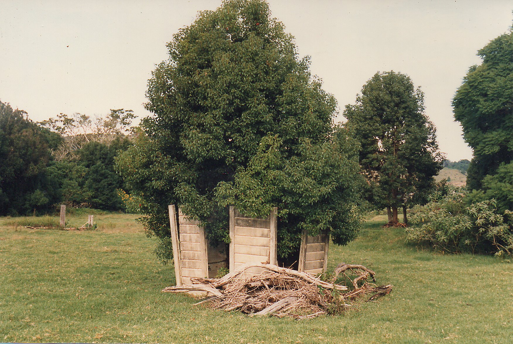
A stretch of embankment continues from a fenceline up to the grove of camphor laurels that shade the remains of the waiting room. Partly collapsed, it contains several concrete uprights plus a few surviving panels, with one side of the building largely intact. A number of loose panels are lying around on the ground. In an example of improvised construction techniques, a rail has been utilised in the construction, perhaps to give additional structural support. Close by is the original water tank, worn but intact.

Slightly more far-gone is the toilet block, which has lost all but two panels, leaving a set of upright posts. It sits not far away, incongruously basking in the sun.
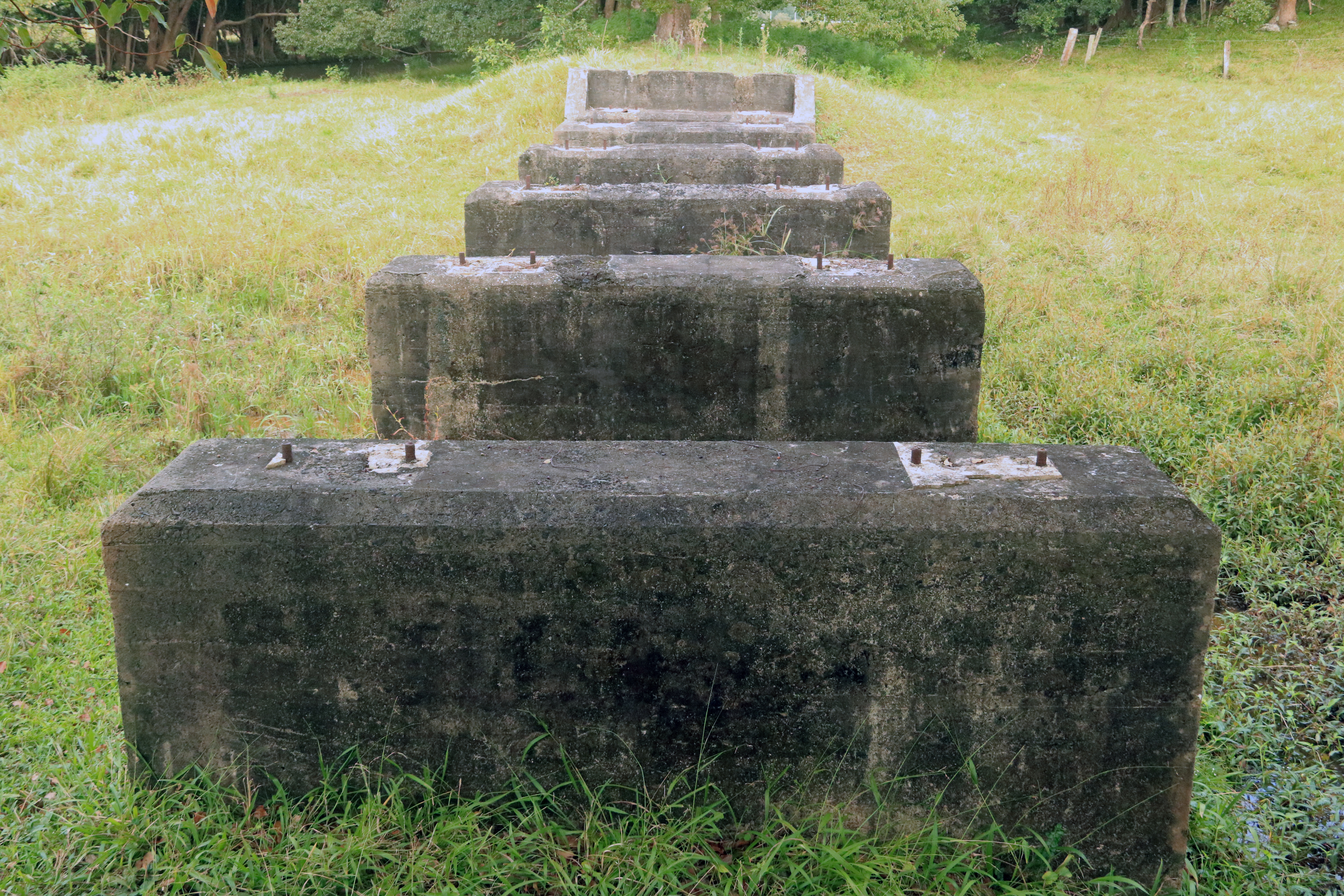
From Teven, the line briefly parallels an intermittent waterway, which crosses the line about three hundred metres further on from right to left. Located around the back of the Old Teven School campground, this is a less well-known remnant, but one that is easily spotted with the help of Google. Depending on recent rain, accessing it can involve crossing a small area of wetland. It contains two end blocks, which double up as convenient seats, and has five others in between.


The land turns pancake-flat, and the line, turning a little to the right, begins a dead-straight three-kilometre stretch roughly southbound through sugar cane country, going through Miroma, and running roughly parallel with Teven Road as it hugs Maguires Creek. Along this part, the line was crossed by tramways used for transporting sugar cane to the Richmond River.
Of all the line’s remnant buildings, the one at Miroma is by far the most easily visible from a public road. A tin shed isolated in fields alongside the line’s elevated causeway, it appears on the satellite image as a white rectangle. The owners of a nearby house are happy to arrange a visit. With wooden supports and a metal roof and walls, it is in remarkably good condition and still serves as a functional storage room. In the summers, it must have been unbearably hot. A wooden platform on the side facing the line was probably used for loading and unloading.


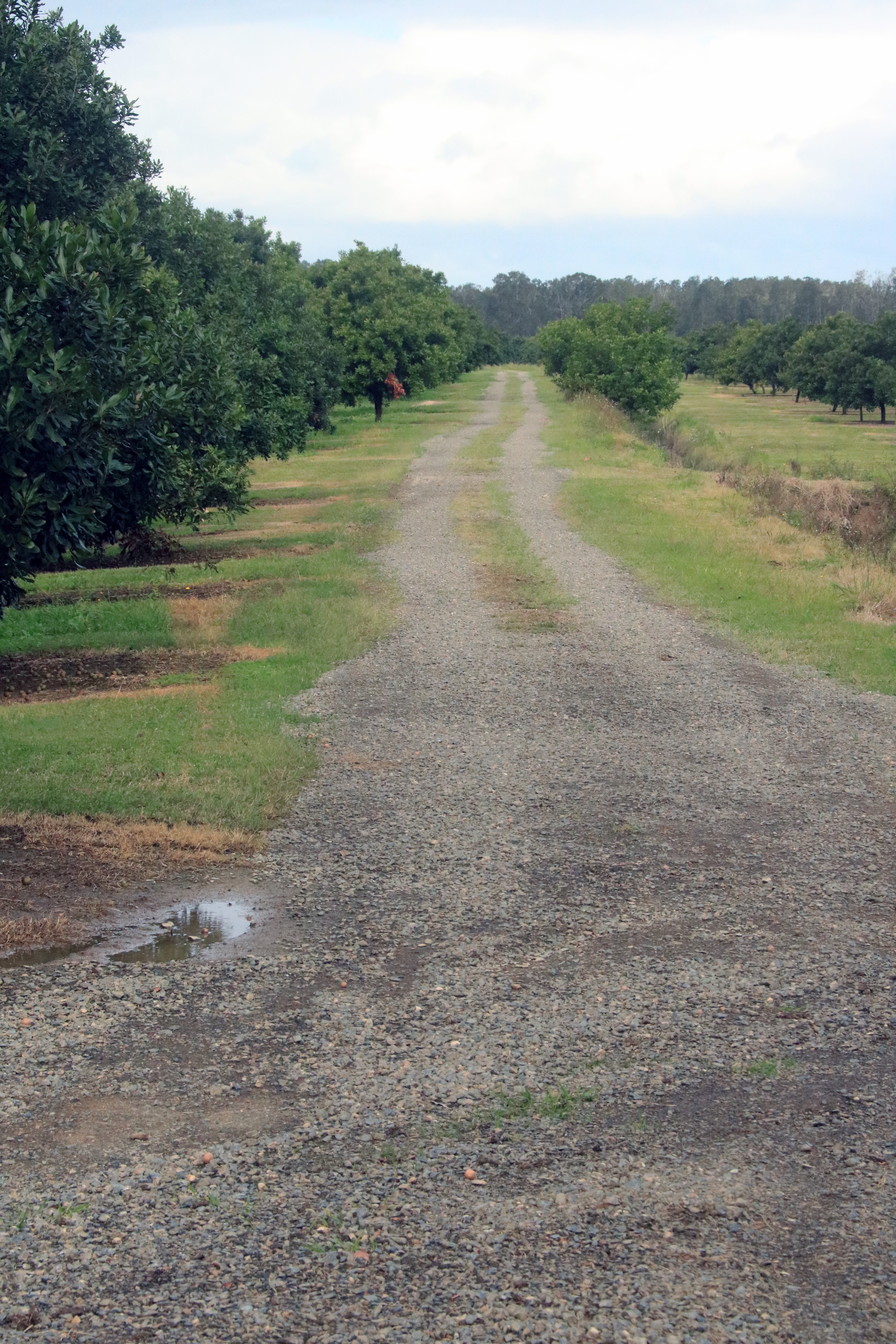
Beyond is the only public-access part of the line that can still be driven, a stretch of dirt track between the canefields, running between Stokers Lane and Wellers Road. Just after crossing Wellers Road, the route goes over a drainage channel with the charmingly eccentric name of Humbug Creek, and passes into a private macadamia farm. In addition to concrete remnants, this crossing has well-worn wooden uprights on both sides.


The next accessible spot is some distance down Teven Road, shortly past the industrial area on the left, and the landmark is a cyclone gate facing west down the embankment. This is the last of the five level crossings, with all line-road crossings between here and Ballina dating from after the line’s closure. From Wellers Road, the line has already crossed about three kilometres of country and passed over Emigrant Creek, the waterway that Houghlahans Creek and Maguires Creek eventually flow into. Looking over the gate, to the left is a lake rich with waterbirds. A trek of about ten to fifteen minutes takes you to the creek crossing, with its massive concrete pylons that could have been used equally effectively in the building of castles.


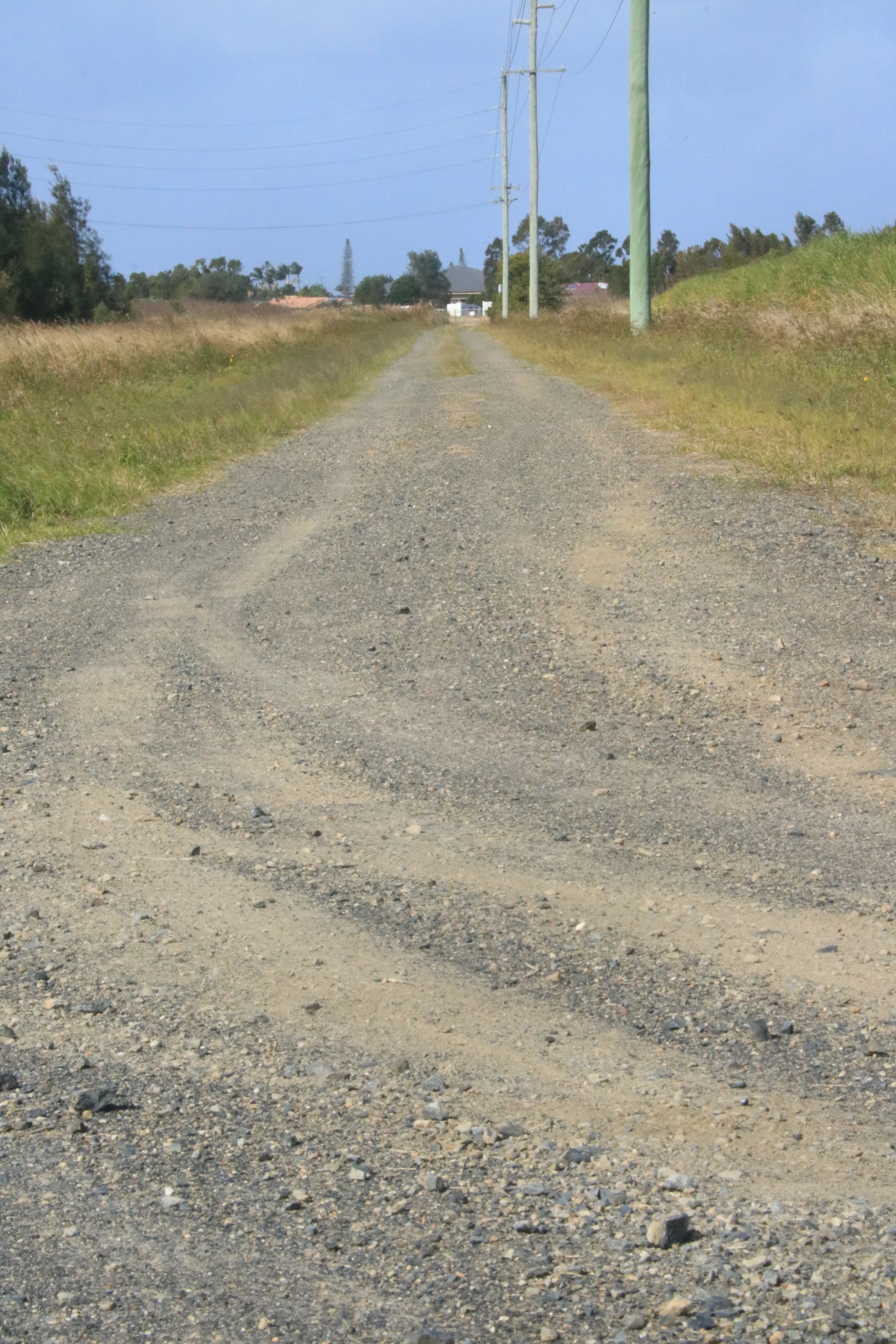
From here, the line enters a kind of semi-industrial no-man’s land before crossing the Pacific Motorway. Taking the Ballina exit from the roundabout, the first unmarked road on the left involves a tight hairpin bend that doubles back to hug the motorway. This road is signed as being a construction zone, with no other vehicles permitted. If continuing along here on foot, the first road on the right takes off at an acute angle, running straight along the rail route to the northern edge of Riverbend Village. From there, it passes through a suburban area of West Ballina on the way to Fishery Creek. When I went back to try to locate the name of this track and the access road, both had been deleted by Google Maps.
In the 1940s, West Ballina was very undeveloped, and largely rural. The same is not true today.
Taking Barlows Road, off River Street, the landmark to look out for is Ballina Sand and Gravel. To the right of these premises is a short, grassy track leading to Fishery Creek. Because this area is so overgrown, it is very hard to get a good view of the bridge remnants. Checking them out from the creek would work far better, if you have access to a boat.

The second-to-last road crossing is further down River Street towards Ballina, along the next left turn which is Fishery Creek Road. This makes a few bends and ninety-degree turns, before starting on a straight stretch and passing through the gates to the wastewater treatment plant. A track off to the left close to a group of trees marks the route, while on the other side of the road, only a gate remains.
Canal Road in West Ballina offers good access to the most dramatic of all the publicly visible remnants. Huge piers crossing North Creek Canal have a plaque about the rail line (the only notice of its kind along the entire route), and as with Fishery Creek, it is crossed by a modern-day sewerage line. Despite being built to open in the middle, this never took place because taller boats were prevented from penetrating upstream by the River Street bridge to the south. An interesting aside is that when this bridge was being dismantled, a counterbalance from the opening mechanism fell to the ground, chipping a pier en route, and landing in the soft mud where it was left and can be seen today. It can easily be reached from the Canal Road bank.


After crossing the road and the bowling club green, the line passes close to the bowling club shed, which sits on the site of the old dip yards. Passing through the northern end of Fripp Oval, it continues through the TAFE grounds, where close to the car park there is a large elongated planter. It has a two-tier construction, and is made from a mixture of stone and concrete. This is the former railway ash pit, whose demolition in 1950 was abandoned due to its bulk.

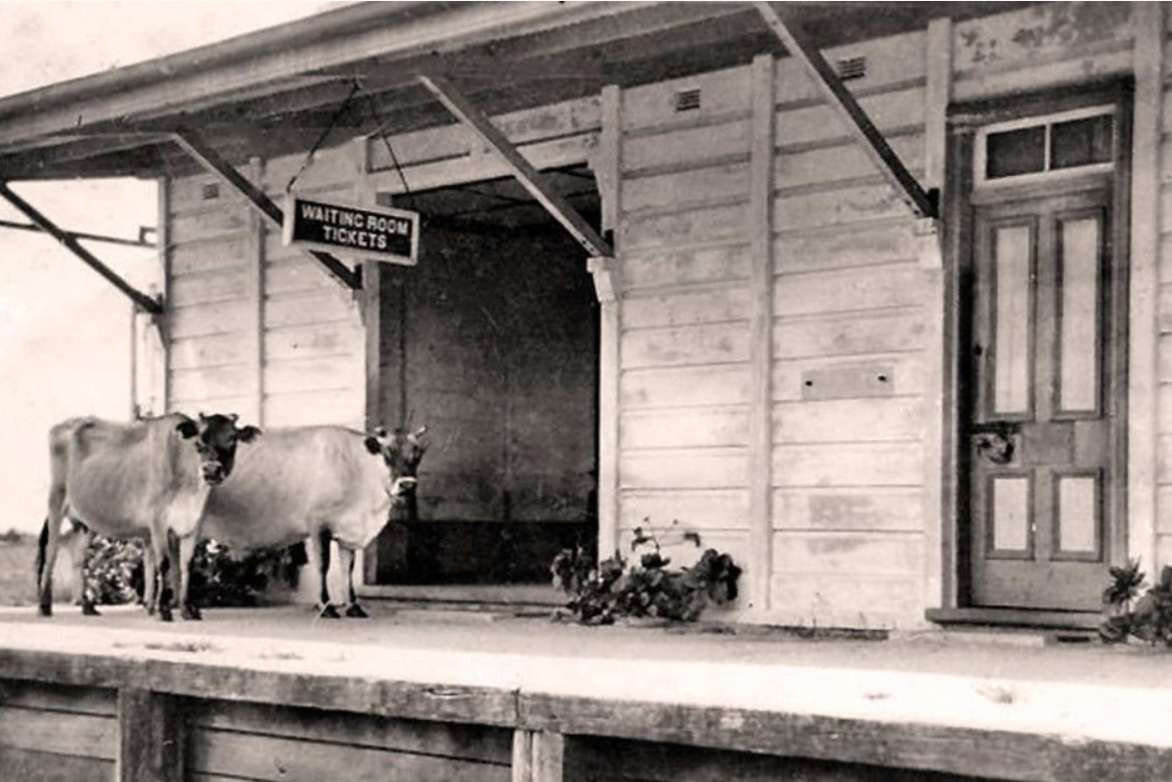
The end of the line now lies in a corner of Saunders Park, very close to a row of large native figs. Ballina Station once featured stockyards, a rail shed, and sidings, but no trace of them remains. Because no facilities were ever built to enable engines to turn around, it was necessary for drivers to push the carriages backyards on the return trip.

According to a news item in the Northern Star, the engineer’s house stood at 150 Tamar Street, Ballina, little more than a hundred metres from the former station site.
Very soon after the line closed, in 1949 the station-master’s house on the station grounds was purchased, dismantled, and then rebuilt at considerable effort on Tamar Street, where it still stands today. This undertaking took place prior to the modern era of house removals.


The station building itself became Ballina’s first motel in 1953, later closing around 1962. According to the website NSWRail.net, it was apparently relocated to Kays Road, Coolgardie, 14 kilometres south of Ballina, where it was used as a dwelling.
Investigations by Allan tell a different story. According to people that he has spoken to, after its use as a motel the station building could not be relocated due to its concrete panelling construction, and was demolished. A shed from the former station went to the Ballina Shire Council waste facility at the end of Southern Cross Drive, where it was used as an entrance office. Later on, it was moved to Kays Lane, Alstonville, where it became a clubhouse at a model aircraft field. Perhaps there is someone who could shed some more light to verify this.
Kays Road, Coolgardie, has a derelict historic wooden house that has so far escaped demolition, and which was earlier speculated to have been a candidate for the former station. This was apparently a building from the former Bagot Brothers sawmill along Fishery Creek that was relocated in the 1970s.
When writing about a potentially depressing topic such as a doomed railway line, it can be easy to focus on its dysfunctional elements. There was the long delay in commencing the project, the cost overruns, the poor location of Ballina Station, and economic failure. Seven years of effort went into building a line which had an active life of eighteen years. Yet, what remains can be seen as an extra layer overlaid on the landscape, which hopefully enables you to view it from a different perspective.

Excellent research. If only they retained the land and it could have been be part of the future rail trail . Thanks for the effort.
LikeLike
Thanks for the great feedback. Unfortunately the thinking back then did not extend to future recreational uses of the line.
LikeLike
It’s so sad that this little line, which would have been so quaint and cute and a real tourist attraction today was lost to the clean lines of modernity and commercial expedience of the day.
It strikes me how quickly our infrastructure and habitations can disappear, overgrown with weeds, rezoned and reworked and wiped from the surface of the landscape in just a few short decades.
Great read. Makes me wish I was there.
One thing, I’m having difficulty seeing the whole picture. I would like to see a birds-eye view of the area with the whole length of the track depicted on it.
LikeLike
Thanks for the feedback. The best way to get an overview of the route, other than through Google Earth images, is an earlier version of the 1:25,000 Lismore map, which shows the line route from close to Booyong at the northern edge to well south of Teven at the southern edge. This extends into an earlier version of the 1:25,000 Ballina map. These maps can be accessed online, but the current versions don’t have the line on them.
LikeLike
A very interesting article and well researched. I was raised at Teven at our family farm, ‘Rocklea’ from the late 1940s to late 1960s. As a 4 year old I recall seeing the steam locomotive and have always kept a picture of it in my mind. I believe however that it was during the period that the service had stopped running and the line was being pulled up behind the locomotive. The line went through our property after crossing the Teven railway bridge and near to Houghlahans Creek Road commencement, towards Booyong.
I believe that the Nioka Platform was on the property of William Henry Jones who was the local livestock carrier in the district and I believe that it had been owned by the family for many years prior to our family moving to Teven. The Newton family (Coral, nee Jones) was next door to the Jones property,
My brother and I (sometimes my sister) spent many happy times sliding down the railway cutting on our butts in the area immediately after the Teven railway bridge and further along. We often saw evidence of railway material. A lot of the stones around the line were used in concrete and around our farm.
The Teven Station was used as accommodation for the Cattle Tick Inspectors when they would attend to dip cattle. Various paddocks on our farm had names and one familiar to me was the ‘Railway Line paddock’.
I would love to say that as I was growing up I heard many people say that they were sad that the railway service was gone however I didn’t hear anyone say that. Most seem to think that it was wasted money and the Ballina end left a lot to be desired, both in location and pickup by others. We had a truck where produce could be taken direct to Ballina, Booyong and Lismore. I don’t recall my family ever mentioning the use of the train. I would however give almost anything to go back in time and take a steam train journey from Ballina to Booyong.
LikeLike
Thank you for this eyewitness account of the line while it was still in use, in a manner of speaking. In particular, your clue about the Newton family will hopefully help to establish the location of the Nioka platform.
LikeLike
A wonderful article to read, and thank you for taking the time to explore and document the line. I have a photo of the station masters house at Pearces Creek “The Meadows” from 1923 if you would like it. Let me know your email address
LikeLike
Hi Jared, thank you for the kind words. I would be very interested to see the photo. The address to send it to is uniquelynorthcoast@gmail.com
LikeLike
The Meadows was not the stationmaster’s house. It was a private house owned by the Kirkland family, in this case Hugh Alexander, a son of Hugh Kirkland, an original selector who gave land for Pearces Creek Hall.
LikeLike
Hi Ian, thanks for this useful clarification. I guess that if there were a station-master’s house at The Halt, it would have been another property nearby.
LikeLike
I believe the Booyong to Ballina Railway Line was part of a ‘grand plan’ to bring produce and wheat and cattle from the Moree district down to the Coastal Ports at Ballina and Byron Bay. A line was built from Moree to Inverell, but never crossed the river there and on to Glenn Innes. A line was started to be built from Casino to Bonalbo and was proposed to link up to the New England Line somewhere near Tenterfield. Construction only got a few miles west of Casino, much of which is still visible today. If those lines had proceeded there would have been a direct line from Moree to Ballina and Byron Bay. Probably the biggest drawback to the Ballina line surviving was its terminating position, it was too far from the river port. It was a heavily constructed line, big bridges, deep cuttings and high embankments. The Mayor of Ballina at the time must have had a lot of influence with Parliament.
LikeLike
Hi Dudleigh, thanks for an interesting perspective on the line. I’m aware of the planned line running out west from Casino, which is on a list of possible future topics to cover. My understanding is that its intended destination was Bonalbo. The link at https://www.nswrail.net/lines/show.php?name=NSW:bonalbo provides some brief details.
LikeLike
Mr Bruxner preferred road to rail. The line is described in my book Forgotten Railways and got as far as Mummulgum with embankments.
LikeLike
Thank you for a well written and researched examination of more of our heritage. I have a great desire to work to maintain our connections with our past by using some of this property to make them into cycle and walking tracks. This does not necessarily mean that they have to be passed to National Parks, but they can be declared public ways open to all who respect their country and heritage.
LikeLike
It would be great to see stretches of the former line used for those purposes. Challenges might include access land that is now private property, and managing cases where the route doubles up as a driveway track into a property.
LikeLike
great work Martin very good
LikeLike
Thanks for all of your helpful information, and for your tips in tracking down these places, which both helped make the project less of a challenge.
LikeLike
you were welcome Mate
LikeLike
I lived on a cane farm at Teven in the 70s & 80s with the old line going through the middle of the farm. Had fun as a kid exploring the Teven station. The dead straight part of the line you refer to was used by us teenage boys as long drag strip to see how fast we could go on our motor bikes!
LikeLike
Great to hear your story.
LikeLike
I was just reading about Parliment passing the bill to close two sections of the Casino to Mur-bah line to enable the rail trail construction to commence when I found your story. It was a very interesting read, thanks for researching and putting it together.
Have you had any luck finding the location for Nioka platform yet? If not, might I suggest that you have a look at an old Parish map of the location. They are available online at https://www.nswlrs.com.au/Parish-and-Historical-Maps It can be confusing but the map that may help is Teven Parish – Rous County – Grafton District Office. I have used these maps extensively and on this particular one I saw that a William James purchased Portion 174 and the railway ran through that property. It seems to be in about the right location for where it may have existed.
If you think that it might be worth following up then the Grafton Office of the Lands Department (I don’t think that they are named that any longer actually, Government Agencies seem to change weekly) should have the survey plans of that Portion which you could view if you visited them. As another tip the plan is catalogued as 9165.1759. Some of the survey plans are really quite detailed showing building and fences and such structures whilst others can be quite plain.
Anyway, good luck.
LikeLike
Thanks so much for this information. I’ll hopefully have time to look into it soon. If not, I’m sure that other readers will be able to use it in their investigations.
LikeLike
Very interesting reading, was lucky to collect as a kid Dad’s A model Ford, train Old Casino to Ballina, station a way from the North Coast Steam shipping Co. era around 1946-1948! Much history, I wrote the book and published as an ex. NSWGR Blacky from Loco Casino, Steam Days on the North Coast of NSW, plus a few re Eveleigh Railway Workshops. Another on the way. Sad to loose the branch lined
LikeLike
Thanks for sharing your unique perspective on the line, and for details about your book, which I’ll look out for.
LikeLike
Great research and stories. How do I get in touch with the author directly?
LikeLike
Hi Richard, it’s best to email uniquelynorthcoast (at) gmail.com
LikeLike
When in my teens, I found this line and walked a fair way along it on the embankment where possible. Having been raised in the Alstonville area. There are many discoveries to be made in the area such as the stone creek crossing just south of the Alstonville by pass south of the cemetery also the Opal diggings at Teven and Tintenbah David Mathers.
LikeLiked by 1 person
Thanks for sharing your insights. I was going to write something about Teven’s opal mining by visiting an old mine, but it didn’t come about. I’m also interested in the stone creek crossing near Alstonville.
LikeLike
I’d be interested in further details about the creek crossing. Thanks. uniquelynorthcoast (at) gmail.com
LikeLike
Hi Martin, my father,Gordon Dowse, lived at Fernleigh. He walked to Tyumba station and caught the train to high school in Lismore, changing trains at Booyong.
He had many stories about what the kids would get up to during that train trip. The goods carriage was at the back of the train. If the guard wasn’t particularly vigilant the kids could get into the carriage and help themselves to an ice cream. The ice cream was carried in heavy canvas packs with ice in it to keep it cold. I’m not sure if it was dry ice.
Some poor shop keeper in Ballina would be short of stock. I assume the ice cream came from Norco.
Sometimes the train would be held up by other rail traffic and they would be late for school. They had to walk from the North Lismore station into the old Lismore High now the Conservatorium and Art Gallery. Do it all again in the afternoon.
LikeLike
That’s some fascinating history. Thanks for sharing it.
LikeLiked by 1 person